


Tsunamis: how to catch them with GNSS
The versatility of Global Navigation Satellite Systems (GNSS) and the wide range of their potential applications has been evident since their first deployment, with the launch of the first GPS and GLONASS satellites more than 40 years ago. At present, 6 constellations are available (GPS, GLONASS, BeiDou, Galileo, QZSS, NAVIC), which, in addition to allowing positioning and navigation at different levels of accuracy (their primary objectives), are of particular importance in various applications of Earth observation.
One of these applications, called ionospheric seismology, has gradually acquired importance after the great earthquake and the consequent disastrous tsunami in Sumatra in 2004, and it has significantly developed in the last decade thanks to the larger and larger availability of GNSS satellites.
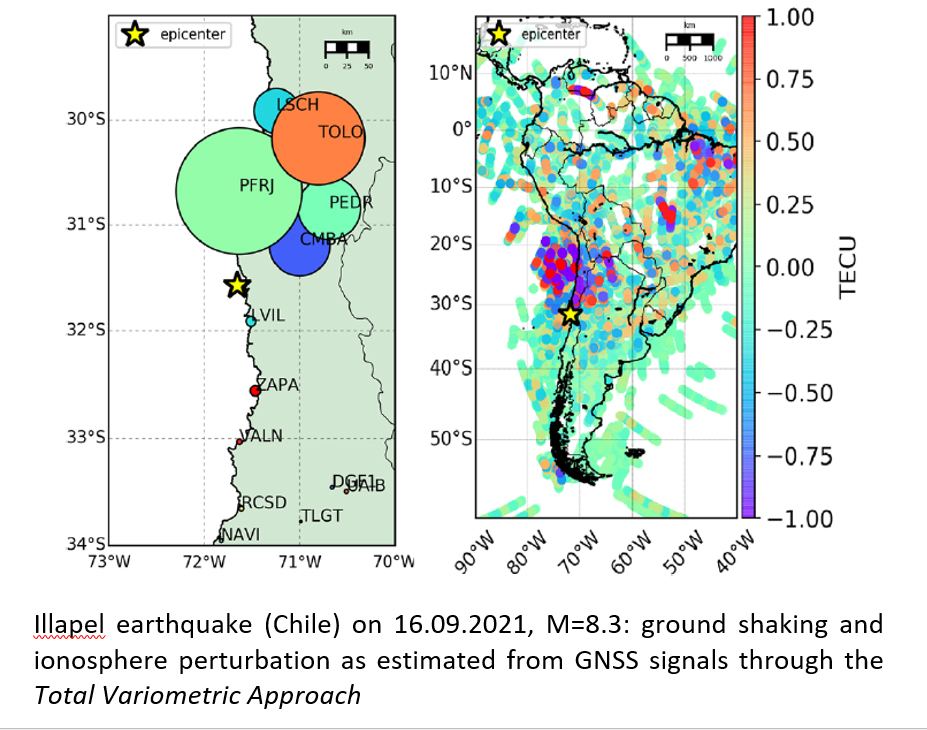
Ionospheric seismology therefore deals with the detection of ionospheric perturbations caused by earthquakes and consequent tsunamis. In fact, these events (similarly to strong explosions of natural or anthropogenic origin) trigger acoustic and gravity waves that propagate vertically in the atmosphere and reach the ionosphere, inducing perturbations in its total electron content (TEC).
These perturbations can be highlighted thanks to appropriate methodologies for analyzing GNSS signals; these methodologies, when able to provide information with limited time latency, can significantly contribute to enhance the low reliability of early warning systems for tsunamis.
The issue therefore has significant civil protection importance at an international level and was the subject of a 2015 resolution of the International Association of Geodesy and Geophysics, which led to the establishment of an international study group.
One of these methodologies (Total Variometric Approach - TVA), able to work in quasi-real time (with latency of a few minutes), was invented at the Geodesy and Geomatics Area of the Faculty of Civil and Industrial Engineering: TVA allows hunting for tsunamis with GNSS.
Mattia Crespi
Geodesy and Geomatics Division-DICEA, School for Advanced Studies - Sapienza University of Rome
Michela Ravanelli
Geodesy and Geomatics Division-DICEA - Sapienza University of Rome
Institut de Physique du Globe, Université de Paris, France
Giorgio Savastano
Geodesy and Geomatics Division-DICEA - Sapienza University of Rome
Jet Propulsion Laboratory - NASA-Caltech, Pasadena, USA