


A machine learning-based approach for mapping leachate contamination
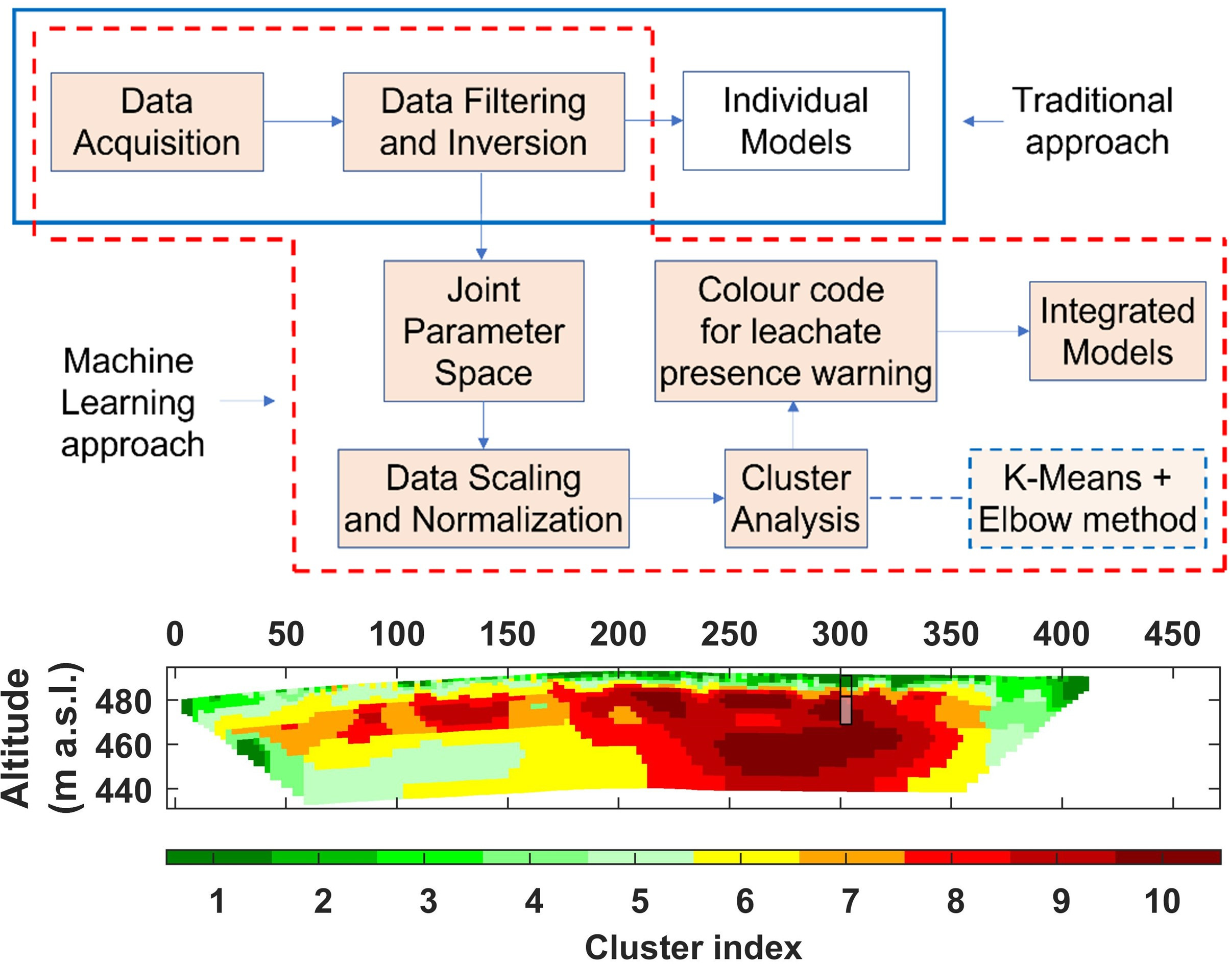
Leachate is a liquid arising in landfills from rainfall or groundwater seepage into the waste mass or from the waste decomposition. The production of leachate in urban waste landfills represents a potential threat for human health and the environment since it can likely pollute the groundwater. The negative impacts of the leachate pollution can continue for several years even after landfill closure. In recent years, geophysical methods (non-invasive and eco-friendly tools) have been widely used for “seeing the unseen” within the landfill (using the same principles of a medical CT) and providing an imaging of the leachate plume. However, they produce subsurface cross-sections in terms of individual physical quantities, leaving room for ambiguities on interpretation of geophysical models and uncertainties in the definition of contaminated zones.
In this work, Prof. Giorgio De Donno and Davide Melegari (Ph.D. student) from ICI DICEA, along with their colleagues Prof. Ester Piegari and Prof. Valeria Paoletti (University of Naples “Federico II”– DISTAR), have developed a new methodology based on a machine learning approach for mapping leachate contamination through an effective integration of geoelectrical tomographic data. The proposed approach, applied for the characterization of two urban landfills in Italy, is effective to get integrated cross-sections which provide an easy and less ambiguous identification of the leachate accumulation zones. Our findings, validated by borehole data, show that the combined use of geophysical imaging and machine learning is promising and can yield new perspectives for the characterization of leachate distribution and pollution assessment in landfills.
More info: https://www.sciencedirect.com/science/article/pii/S0956053X22006031?via%...